→
SITES
↓


Surveys
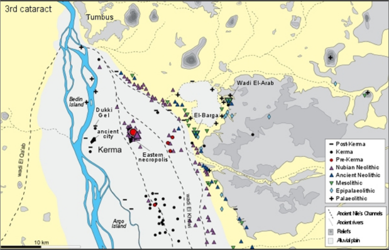
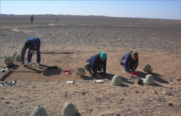
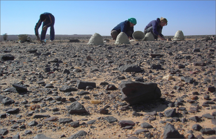
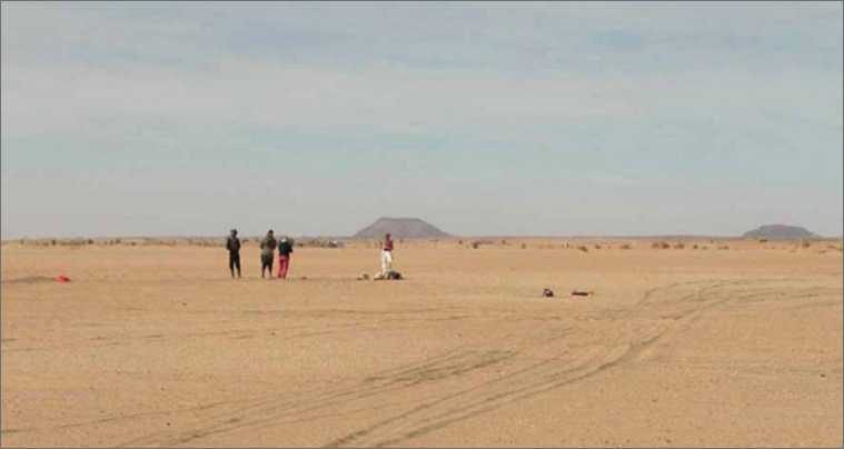
Surveys conducted these last few years enabled the identification of more than a hundred sites and the interpretation of the region’s settlement dynamics.
↓
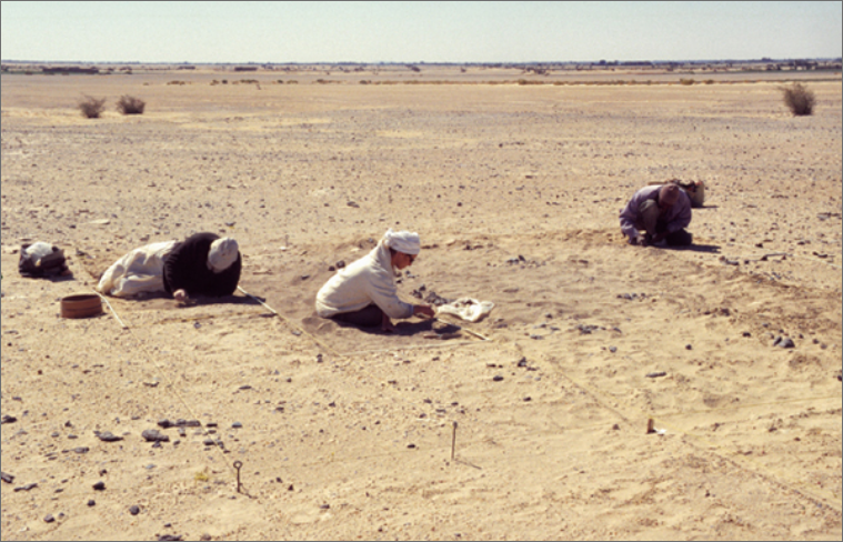
Since 2000, the Kerma region has been regularly surveyed so that the history of its settlement could be reconstructed. This approach also allows us to evaluate the region’s archaeological potential as well as observe the conditions of the sites and identify possible threats of destruction. These surveys focus mainly on zones bordering the alluvial plain, where settlements are better preserved. The remains of Middle Palaeolithic and Epipalaeolithic settlements were discovered during a few desert expeditions.
In total, 137 archaeological sites were identified. While certain might be eroded and partially destroyed by agriculture, others are better preserved and of great interest. Archaeology of the Kerma region is greatly threatened by the extension of agricultural fields and the development of irrigation projects. Salvage excavations are planned so that threatened deposits can be fully documented before their destruction.
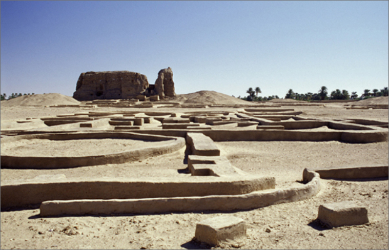
DOUKKI GEL
The Egyptian city of Dukki Gel, founded by Eighteenth Dynasty pharaohs, was occupied from 1450 B.C. to 400 A.D.
↓
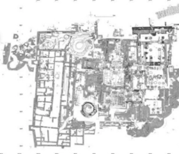
The city supplanted the ancient capital of Kerma, located one kilometre further south. Over the last ten years or so, it has been the object of archaeological excavations concentrating on the religious quarter. The area comprises temples, a 70 m long processional avenue, a palace building as well as enclosure walls with small rectangular bastions. Two large wells, essentially ceremonial in function, are also part of this religious complex. The north well has wide stairs resting on a stone plinth, the masonry of which is characteristic of the Classic Kerma period. The south well’s two entrances are subterranean and vaulted, and located at different levels. Most likely were they laid out amidst the ruins of a sanctuary abandoned early in the Eighteenth Dynasty.
The Napatan and Meroitic temple annexes are located west and south of the religious quarter. These regroup workshops and magazines needed for the production of bread, beer and meat offerings. Bread was baked in terracotta moulds, the remains of which have eventually formed a rather impressive mound that gave the site its name. Dukki Gel literally means “red mound.” With the exception of a few burials unearthed in the modern city of the Kerma, the contemporaneous necropolis has yet to be found.
DOUKKI GEL
The Dukki Gel Cache
↓
During the clearing of a temple in January 2003, the excavation of a pit containing 40 black granite statue fragments confirms the site’s importance. It was identified as a favissa, where venerated sculptures were deposited for safety, handled with great care. The statues were deliberately broken in order to destroy the “power” of the pharaohs represented: all are broken at the neck and the legs, and occasionally so are the arms, the mekes cases, the nose or the uraei.
There are seven monumental statues; they represent the two last kings of the Twenty-fifth Dynasty, Taharqo and Tanwetamani, and three of their successors: Senkamanisken, Anlamani and Aspelta, identified by inscriptions on the back pillar. With this discovery, we have confirmation that the site of Dukki Gel truly corresponds to the ancient city of Pnubs because each statue mentions “Amun of Pnubs”, one of the major manifestations of the Kushite Amun.
Tanwetamani and Senkamanisken are both represented twice. The tallest statue is that of Taharqo (270 cm) and the smallest, Aspelta (123 cm). The granite is carefully polished, but some details of the clothing, the adornment or the skullcap are roughened. With this treatment, pigments and fabric covered with a thin layer of gilded gesso could better adhere to the stone.
These statues of the “black pharaohs” help increase our knowledge of a period, of which there was little known evidence at Dukki Gel. The importance of the site increases considerably as comparisons can be made today with the cachette discovered by George A. Reisner in 1916, at the foot of Gebel Barkal. Several years were needed to study and restore the statues, which were likely broken during Psamtik II’s destructive raid on Nubia a little before 590 B.C.
For further information,
Read the publications of C. Bonnet (archaeology), D. Valbelle (epigraphy) and P. Ruffieux (ceramology).
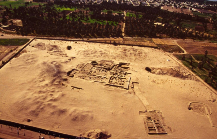
City of Kerma
The city of Kerma is the capital of the first Kingdom of Kush. During its heyday, the kingdom’s territory extended from the First to the Fifth cataracts.
↓
The city was excavated by the Swiss archaeological mission between 1977 and 2002, revealing the complexity of its planning. The city was founded around 2500 B.C., possibly following the abandonment of the Pre-Kerma agglomeration located four kilometres east, due to the silting up of several Nile channels. However, the continuity between the Pre-Kerma agglomeration and the city of Kerma has yet to be demonstrated.
The city was excavated by the Swiss archaeological mission between 1977 and 2002, revealing the complexity of its planning. The city was founded around 2500 B.C., possibly following the abandonment of the Pre-Kerma agglomeration located four kilometres east, due to the silting up of several Nile channels. However, the continuity between the Pre-Kerma agglomeration and the city of Kerma has yet to be demonstrated.
The city is protected by walls, bastions and trenches, modified as it expanded. During the Middle Kerma period, it fits within a square approximately 170 x 170 metres and possesses six differently oriented entrances. During the Classic Kerma, expansions modify the city’s configuration, and at the end of this period, the city covers more than 20 hectares. While an important avenue goes through the city, the paths that lead to its centre are nothing but narrow passages. Generally, houses are comprised of two groups of rectangular buildings divided by a courtyard. The more spacious houses are near the paths leading to the city’s centre and most possess a courtyard with a winding wall, where the kitchens, silos and domestic annexes are located.
The identification of the well-defined quarters confirms the singular status of this metropolis, probably reserved for the royal elite and the ruling class. The Nubian sovereigns maintained the kingdom’s independence against its conquering Egyptian neighbour for almost a thousand years. The Kingdom of Kerma ends around 1450 B.C. with the conquest of Kush by the Eighteenth Dynasty pharaohs, notably Thutmosis III. They destroyed and condemned the capital and founded a new city 1 km further north, on the site of Dukki Gel.
For further information,
Read the publications of C. Bonnet.
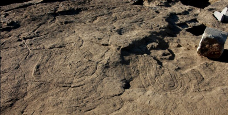
Kerma Necropolis
The Kerma necropolis is one of the most impressive in Nubia, notably because of its innumerable circles of black and white stones that mark the location of the burials.
↓
The Kerma necropolis, contemporaneous with the city, is located four kilometres further east. Its development at this location might be linked to the presence of the Pre-Kerma agglomeration, which occupied the grounds since the end of the fourth millennium B.C. Concurrently with that of the city, the excavations of the necropolis start in 1977. Due to its vastness, the excavations were conducted by areas. The surface of the necropolis is close to 90 hectares and the number of burials is between 30,000 et 40,000; the size of the largest burials is 90 metres in diameter. The excavations allowed us to understand the development of the necropolis, which follows a north-south axis, parallel to the Nile.
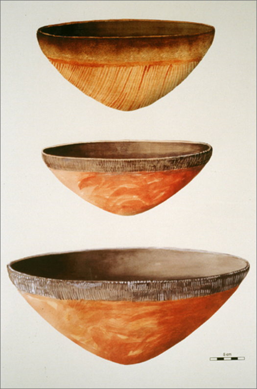
The burials are earthen tumuli strengthened by several concentric circles of black and white stones Their size vary according to periods and the rank of the deceased. In the north, the size of the Early Kerma tombs is relatively consistent. The deceased is placed on a leather blanket; a second occasionally covers the body. He wears a loincloth and the funerary material is limited to a few personal objects (adornment, ostrich feather fans, sandals, dagger). Upon occasion, one or two individuals accompany the deceased. Funerary ceremonies included meals and libations, as indicated by surface offerings placed at the foot of the tumulus: north, dozens of bowls are placed upside down; south, bucrania placed in a semi-circle symbolize the wealth of the deceased. Already at the end of this period, the difference between tombs is marked, notably by groupings around an important burial.
With the increasing hierarchisation of society during the Middle Kerma, this phenomenon will only multiply. The ox hide on which rested the deceased is now replaced by a wooden bed and the offering deposits within the tombs become more and more important. Grave goods now include grooming objects, tools, perfumed oils and unguent in vessels occasionally imported from Egypt. Domesticated animal deposits and pieces of meat found inside the tomb are more common, and the number of bucrania placed south of the tumulus increases. It is not uncommon to find near the deceased several individuals slain on the occasion of the death of the interred. Within the largest Classic Kerma tumuli, G. A. Reisner estimated there were several hundreds bodies. During this period, ceramics are placed inside and in front of the chapels erected near the important tombs. These were broken during funerary banquets as a way to share the meal with the deceased. A practice still found during the Meroitic period.


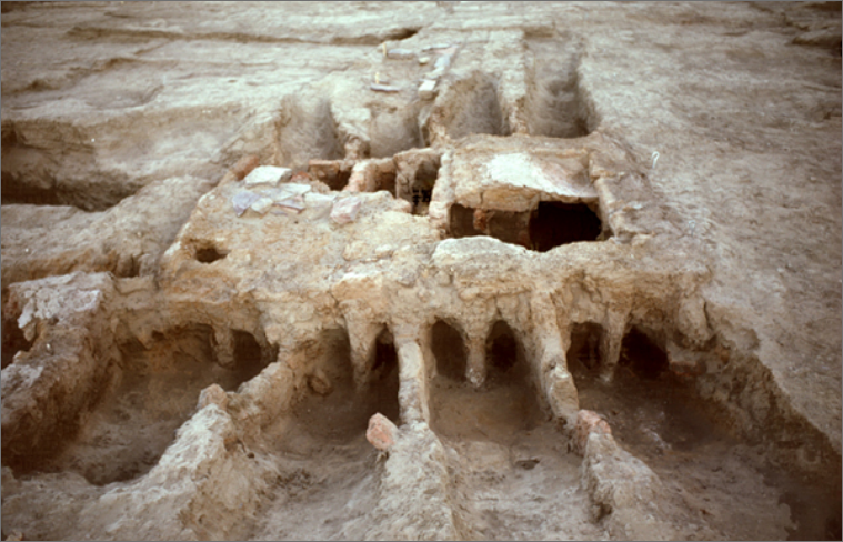
Pre-Kerma Agglomeration
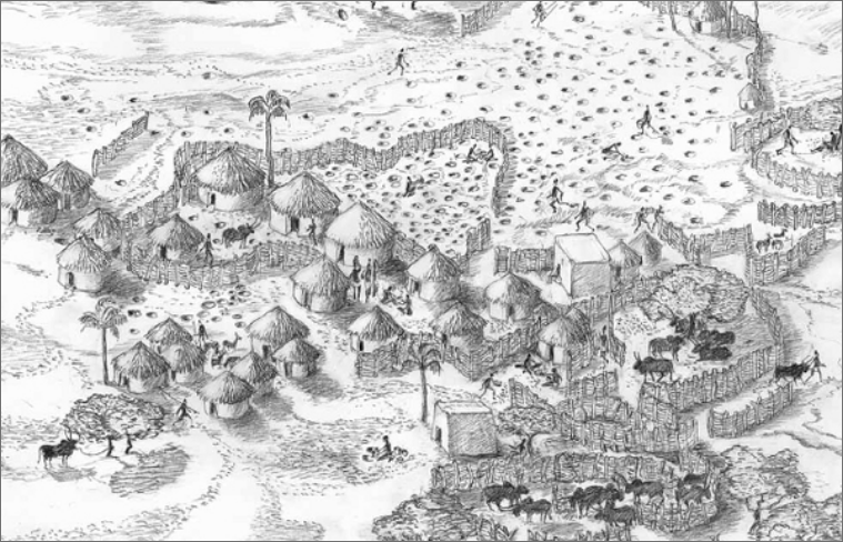
By its scale and architectural system, the Pre-Kerma agglomeration heralds the future development Nubia will know with the emergence of the city of Kerma.
↓
The agglomeration discovered in 1986 by Charles Bonnet was the object of first excavations until 1988. In 1994, Matthieu Honegger re-opens the excavations with extensive clearings of an area in the centre of Kerma’s eastern necropolis.
The agglomeration constitutes an important step towards the emergence of permanent settlements, where a sedentary lifestyle determined by agriculture progressively takes over migration linked to stockbreeding practices. The agglomeration features a unique architecture that follows a Sub-Saharan tradition. Palisades and buttresses made of posts and added-on earth, organized in a circular arc or parallel rows, surround the habitation huts, animal pens and storage pits. Undoubtedly, this is an important defensive system of which only a portion has been unearthed so far. The presence of this feature and the rectangular buildings, which denote a certain degree of specialization, appear to suggest a form of social complexification unknown in Upper Nubia at this period.
The Pre-Kerma period, dated between 3500 and 2500 B.C., leaves many questions unanswered because of the paucity of identified settlements and the scarcity of discovered burials. At the moment, it is difficult to determine its territorial expansion, its social system and its evolution; nonetheless, it is the cultural substratum from which the Kerma civilisation developed.
For further information,
Read the publications of M. Honegger.
El-Barga
El-Barga reveals one of the most important necropoleis of the early Holocene in Africa.
↓
This site was discovered in 2001 during a survey concentrating on the zones bordering the alluvial plain. The name el-Barga is borrowed from a nearby mountain. The site is located on an elevation formed by an outcrop of bedrock (Nubian sandstone) less than 15 km from the Nile, as the crow flies. It includes a settlement area dated to circa 7500 B.C. and cemeteries belonging to two distinct periods.
The habitation is a circular hut slightly less than five metres in diameter, its maximum depth exceeding 50 centimetres. This semi-subterranean structure contained a wealth of artefacts resulting from the site’s occupation (ceramics, grinding tools, flint objects, ostrich eggshell beads, a mother-of-pearl pendant, bone tools, faunal remains, shells). The abundance of artefacts discovered suggests a marked inclination towards a sedentary lifestyle, even though certain activities (fishing and hunting) necessitate seasonal migration.
North of this habitation, about forty burials were dated to the Epipalaeolithic (7700-7000 B.C.) and generally do not contain any furnishings. On the other hand, the Neolithic cemetery (6000-5500 B.C.) located further south comprises about a hundred burials often containing artefacts (adornment, ceramics, flint or bone objects).
For further information,
Read the publications of M. Honegger.

Wadi El-Arab
Wadi el-Arab reveals an almost continuous series of settlement remains spanning two millennia as well as the first Neolithic burials known in Africa.
↓
This site is located today in a desert region. Discovered in 2005, it has been under excavation since 2006. This is an open-air site occupied on several occasions during a period between 8300 and 6600 B.C. Its inhabitants then lived in a rather wooded environment, living on fishing, hunting and gathering.
The site reveals numerous flint tools and flakes, grinding stone fragments, ceramic sherds, ostrich eggshell beads, shells and mollusc remains, fish vertebrae and faunal remains. Rare domesticated ox bones were discovered and dated to circa 7000 B.C. This discovery is important for the question regarding the origin of animal domestication in Africa because it reinforces the idea of a local domestication of African oxen from aurochs living in the Nile Valley.
During the 2006-2007 campaign, six burial pits were excavated in three different areas. Dated to between 7000 and 6600, these burials are the first known Neolithic burials on the African continent.
For further information,
Read the publications of M. Honegger.
Busharia
Busharia reveals the precocious appearance of pottery on the African continent around the 9th millennium B.C.
↓
The site of Busharia is located near the desert, at the edge of the alluvial plain and near an old Nile channel. It reveals the remains of human occupation at the onset of the Holocene. The settlement is rather eroded, only a few artefacts, ostrich egg fragments and extremely old ceramic sherds remain. These sherds date to circa 8200 B.C. The ceramic assemblage is homogenous, which suggests the existence of a single occupation phase. The decorations and the use of the return technique, common in the central Sahara around the 6th millennium B.C., are unique in this Nubian context for such an early period.
Remains discovered on site suggest the existence of a semi-sedentary population living from hunting, fishing, and the gathering of wild plants. A trial trench and a small-scale excavation were conducted on this Mesolithic site; however, it is impossible to obtain at present a better understanding of the context related to the first ceramics in the region. As this site is located near cultivated zones, it is thus threatened with short-term destruction.
For further information:
Read the publications of M. Honegger.

Kaddanarti
The camp remains at Kaddanarti are evidence of the first settlement in the area of Kerma, a million years ago.
↓
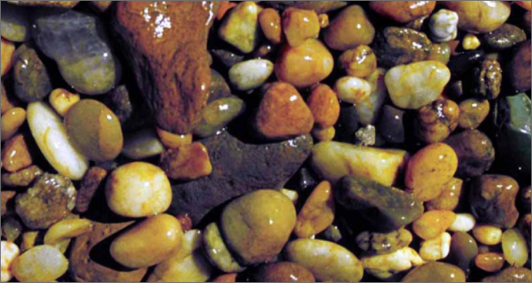
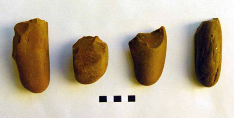
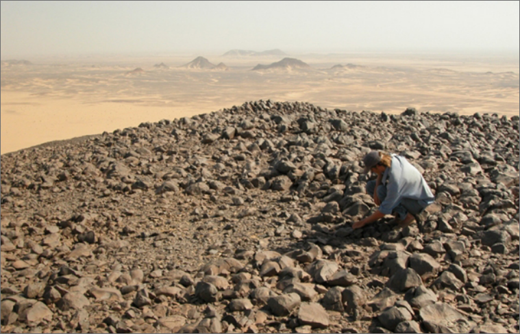
The site was discovered in 1991 during a survey north of Kerma. It is located on Badin Island, approximately 12 km south of the Third Cataract. Several other loci were identified, notably that of Kabrinarti, located at the same level, but on the east bank. Numerous surface collections undertaken between 1992 and 1997 enabled the dating of the assemblage to the Lower Palaeolithic, between 1.6 and 0.5 million years. Pebble tools, bone fragments and the teeth of great mammals make up this assemblage.
The paucity of sites dated to this period in the Nile Valley is probably due to its current stratigraphic position—under several metres of silt. While sparse, the artefacts and remains at Kaddanarti are nonetheless noteworthy as they reveal a very ancient occupation of the region.
TO FIND OUT MORE, VISIT:
The article by L. Chaix, M. Honneger, M.Faure and C. Guérin